Maritime encompasses all activities related to the ocean, seas, and navigable waterways, including shipping, shipbuilding, and port operations. It serves as the backbone of the global economy.
Integrated with artificial intelligence, state-of-the-art technology and AIS data, maritime surveillance has never been more accessible to non-professional users
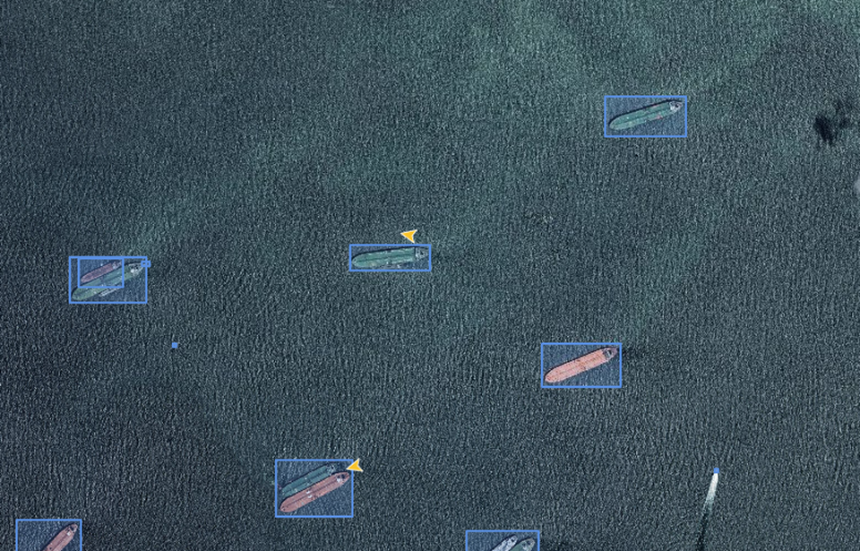
Ship, vessel detection tool utilizes a combined method of remote sensing data and advanced deep learning algorithms to automatically identify and classify vessel and aquaculture farm objects.
The application's functions include supporting the identification of vessels, fish farming areas, while simultaneously track objects of interest in maritime, coastal, and island regions. This tool provides critical information to support management activities in maritime operations, fisheries, and marine economic sectors.
Our partners are the world’s leading data providers to power geospatial workflows. Optimize data management and processing.
Digital Twin
Integrating real-world spatial information into dynamic virtual models. It enables real-time monitoring, predictive analysis, and smarter decision-making.
By identifying resource locations, monitoring infrastructure, and improving grid efficiency. It supports renewable energy planning, environmental assessment.
Tracks changes, biodiversity loss, and climate change impacts through landscape-oriented products like land cover maps, derived from remote sensing data
Mapping infrastructure, monitoring land use, and guiding smart city planning, enabling authorities to optimize civilian factors with data-driven insights.