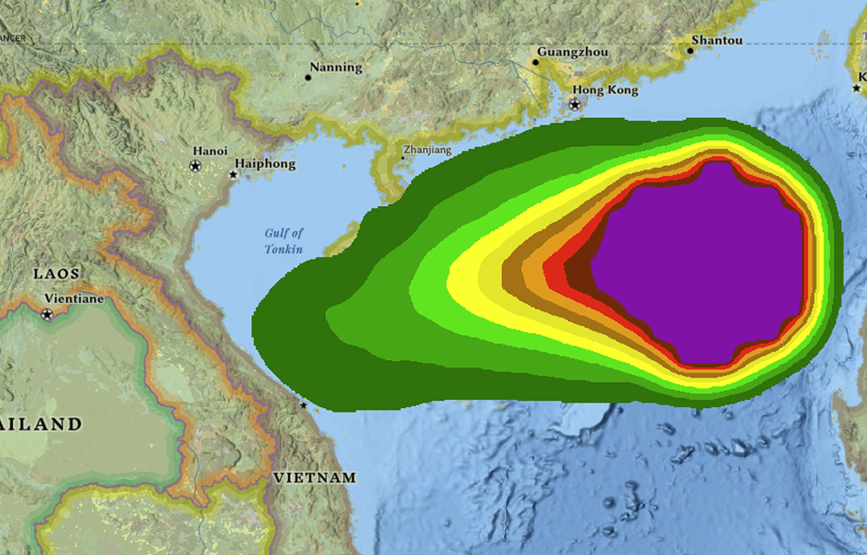
In moments of uncertainty, precision turns chaos into control. Geospatial intelligence delivers timely insights for proactive preparedness and emergency response.
Connect to the world’s leading providers to power geospatial workflows. Optimize data management and processing, with project planning support to turn concept into delivery faster.
Connect to the world’s leading providers to power geospatial workflows. Optimize data management and processing, with project planning support to turn concept into delivery faster.
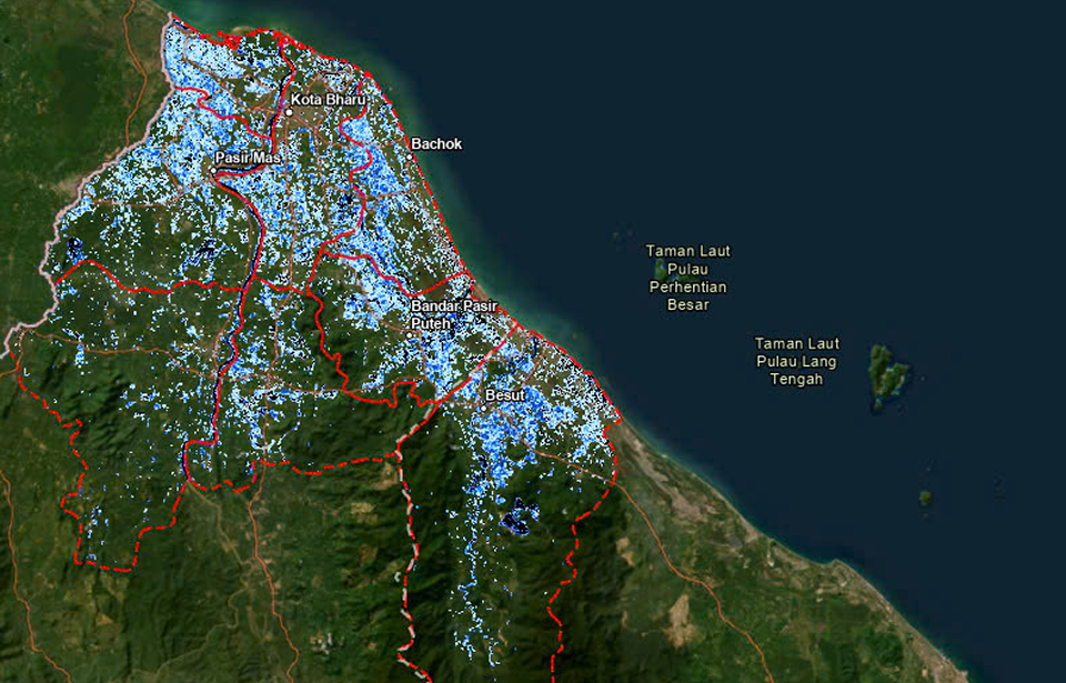
The task is to extract flooded water surface information from Sentinel images during the most severe flooding period in the past 10 years, from November 17, 2024, to January 16, 2025, in eight locations in Malaysia: Tumpat, Pasir Mas, Kota Bharu, Bachok, Pasir Puteh, Machang, Tanah Merah, and Besut.
Our partners are the world’s leading data providers to power geospatial workflows. Optimize data management and processing.
Digital Twin
Integrating real-world spatial information into dynamic virtual models. It enables real-time monitoring, predictive analysis, and smarter decision-making.
By identifying resource locations, monitoring infrastructure, and improving grid efficiency. It supports renewable energy planning, environmental assessment.
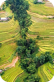
Tracks changes, biodiversity loss, and climate change impacts through landscape-oriented products like land cover maps, derived from remote sensing data
Mapping infrastructure, monitoring land use, and guiding smart city planning, enabling authorities to optimize civilian factors with data-driven insights.