Utilizing state-of-art geospatial technology, we provide specially customized solutions based on different demands. Equipping all industries with the most applicable solution, at shortest time without any expertise.
Connect to the world’s leading providers to power geospatial workflows. Optimize data management and processing, with project planning support to turn concept into delivery faster.
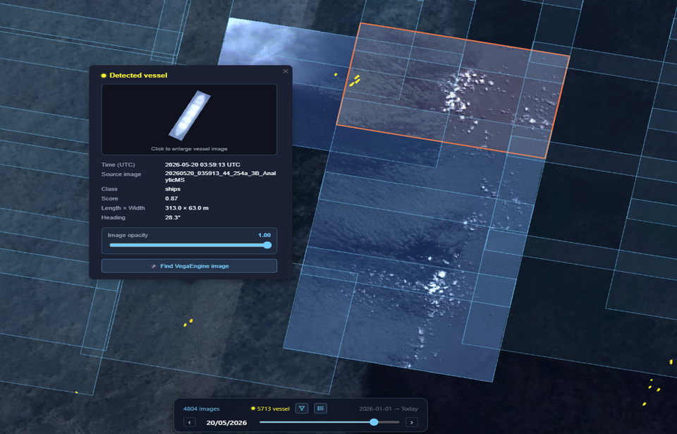
VegaMDA - Maritime Domain Awareness is an innovative geospatial AI platform designed for advanced maritime surveillance. By leveraging state-of-the-art technology and AIS data, it provides real-time monitoring of all vessels, delivering detailed technical specifications, voyage status, and historical tracks even in challenging conditions.
Connect to the world’s leading providers to power geospatial workflows. Optimize data management and processing, with project planning support to turn concept into delivery faster.
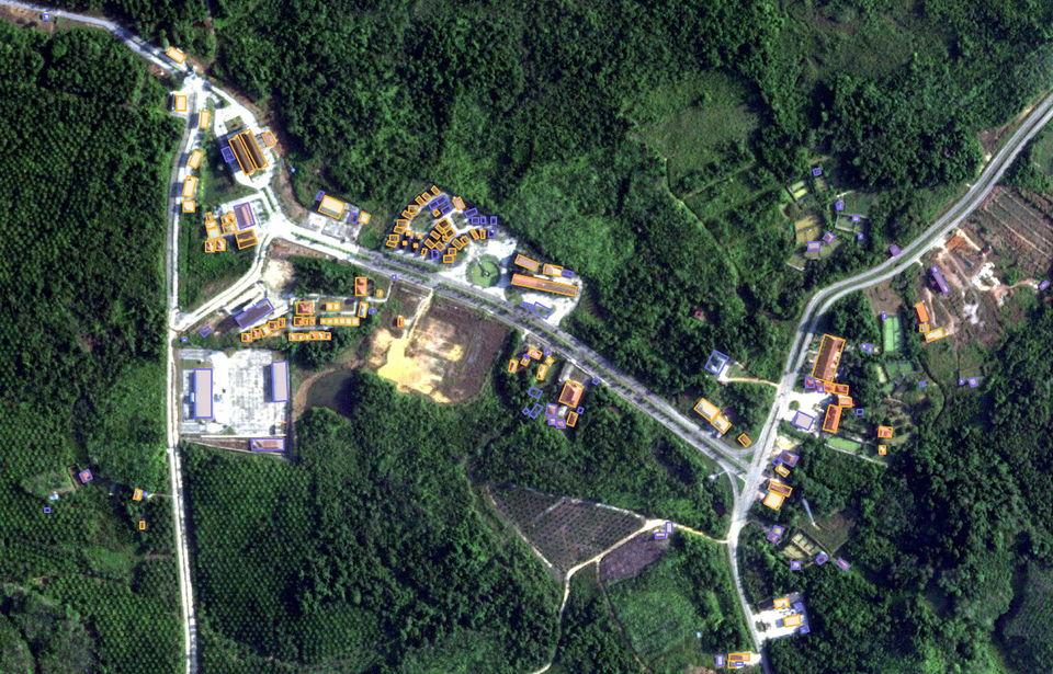
VegaLDA - Land Domain Awareness is an AI-powered geospatial platform designed to automatically detect and visualize changes in land cover and infrastructure development. By leveraging satellite imagery and integrated GIS tools, it allows users to monitor traffic and construction changes over time.
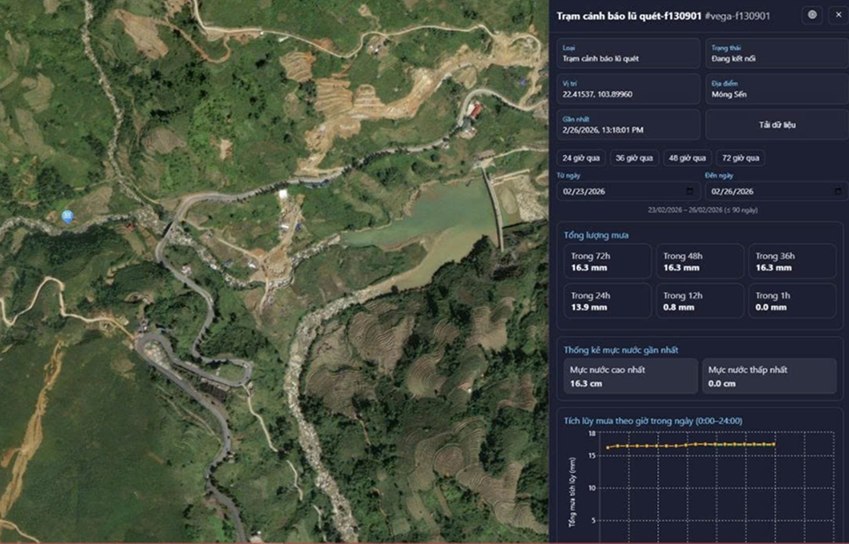
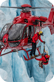
VegaAlert protects communities by seamlessly integrates satellite imagery with real-time IoT sensors to monitor floods and landslides. It delivers life-saving warnings via SMS, outdoor sirens, and a dedicated web platform, ensuring a rapid, coordinated response when natural disasters strike.
Our partners are the world’s leading data providers to power geospatial workflows. Optimize data management and processing.
Digital Twin
Integrating real-world spatial information into dynamic virtual models. It enables real-time monitoring, predictive analysis, and smarter decision-making.
By identifying resource locations, monitoring infrastructure, and improving grid efficiency. It supports renewable energy planning, environmental assessment.
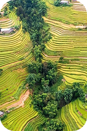
Tracks changes, biodiversity loss, and climate change impacts through landscape-oriented products like land cover maps, derived from remote sensing data
Mapping infrastructure, monitoring land use, and guiding smart city planning, enabling authorities to optimize civilian factors with data-driven insights.